The two banners above were compiled from maps that Kinder Morgan included in their application to expand the Trans Mountain Pipeline.
OIL SPILL SCENARIO MAPS
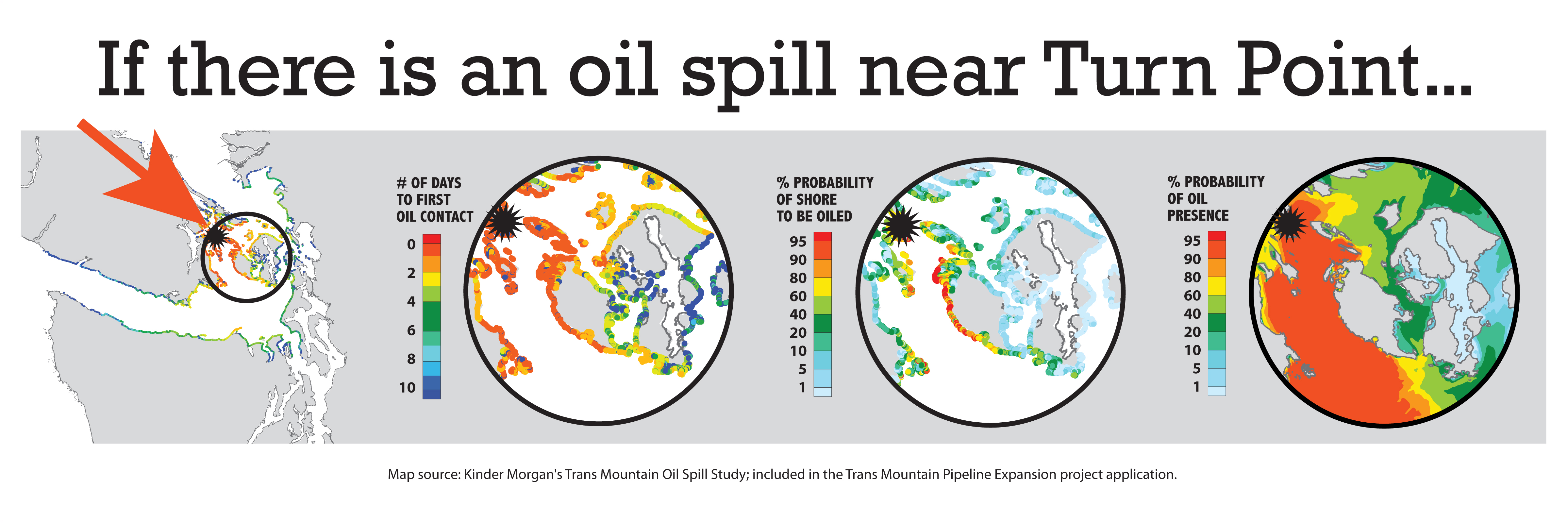
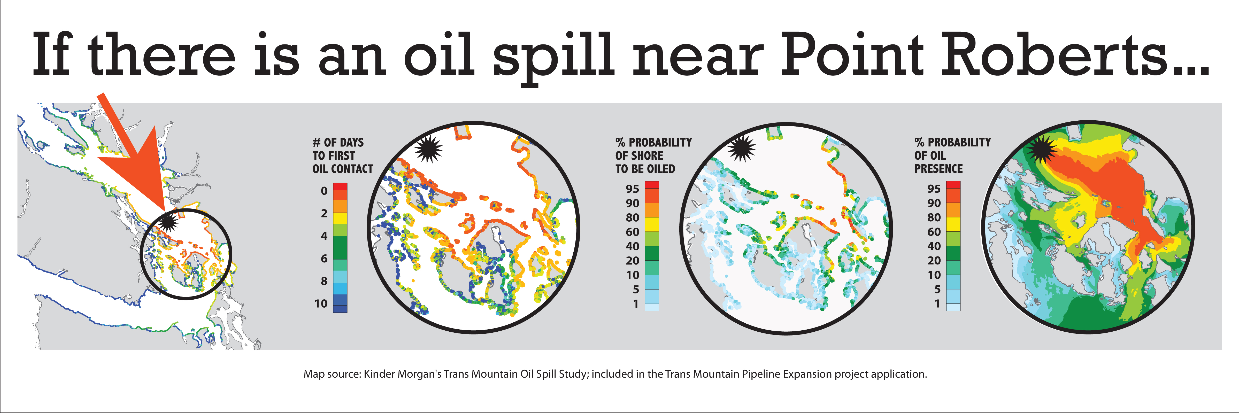
The application for Kinder Morgan’s Trans Mountain Expansion Project includes spill scenarios conducted for five locations where an oil spill involving a project-related tanker is probable. The maps included here show Time to First Oil Contact (days) and Probability for Shore to be Oiled (%) for two possible spill locations that will have the greatest impact on the San Juan Islands (Site D and Site E).
Site D is in the Strait of Georgia between the Tsawwassen Ferry Terminal and the Southern Gulf Islands, where a tanker collision with the high volume of crossing traffic from either the Fraser River or BC ferries is possible. Site E at Turn Point/ Arachne Reef has the greatest level of navigation complexity in the entire tanker passage to the open ocean. This location was also identified as having high environmental values.
Two of the other sites included here are: Site G: Strait of Juan de Fuca, mid-channel off Race Rocks; and, Site H: Western Entrance of Juan de Fuca Strait at Buoy J. The fifth site not shown here is Site A at Westridge Marine Terminal in Burnaby, BC.
A sampling of two maps from each of four spill scenario sites are shown here:

Site D – Probability for Shore to be Oiled (%)

Site D – Time to First Contact (days)
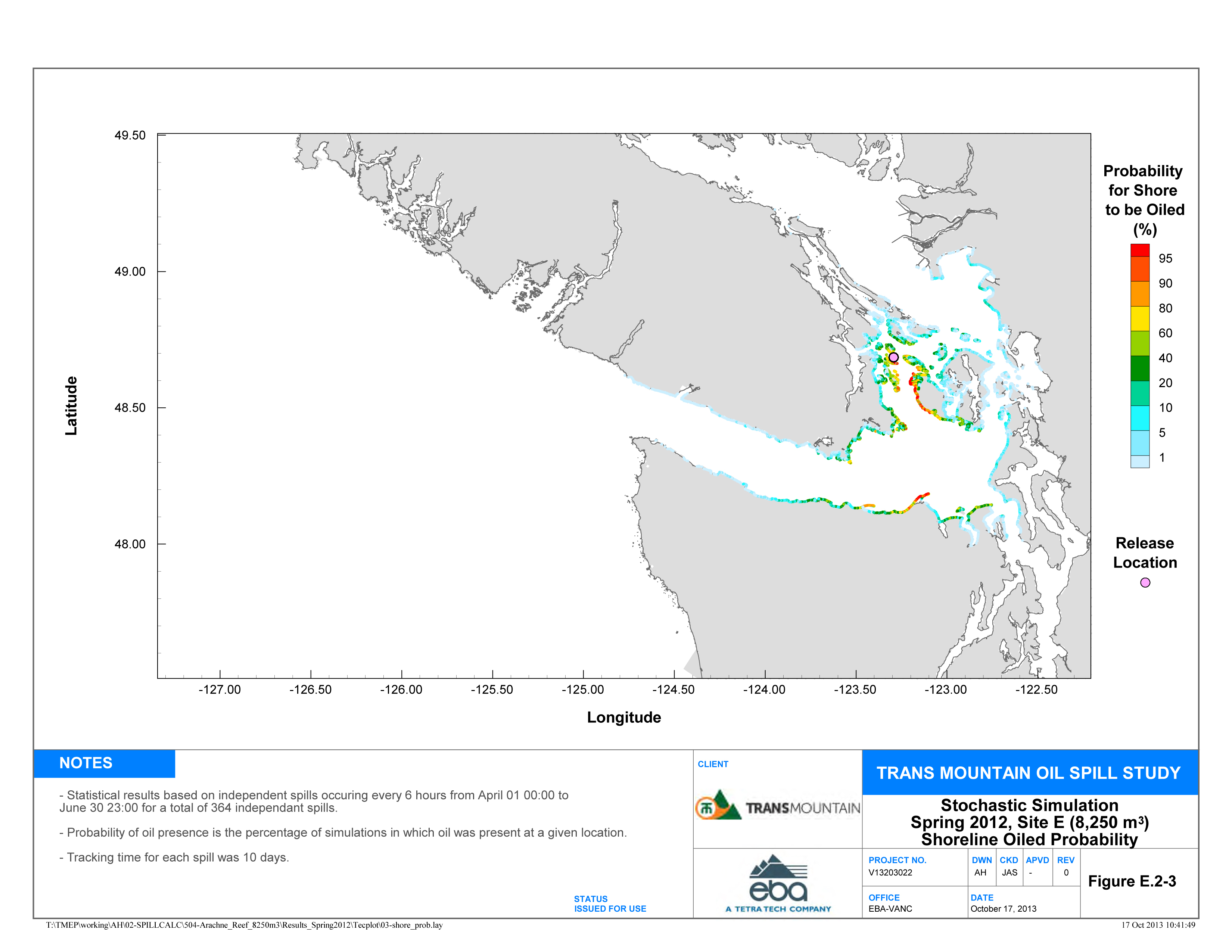
Site E – Probability for Shore to be Oiled (%)
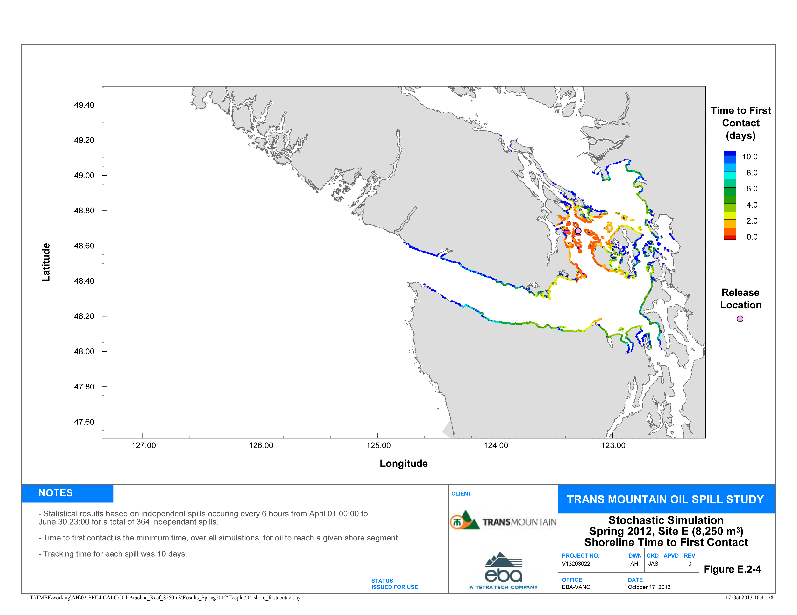
Site E – Time to First Contact (days)
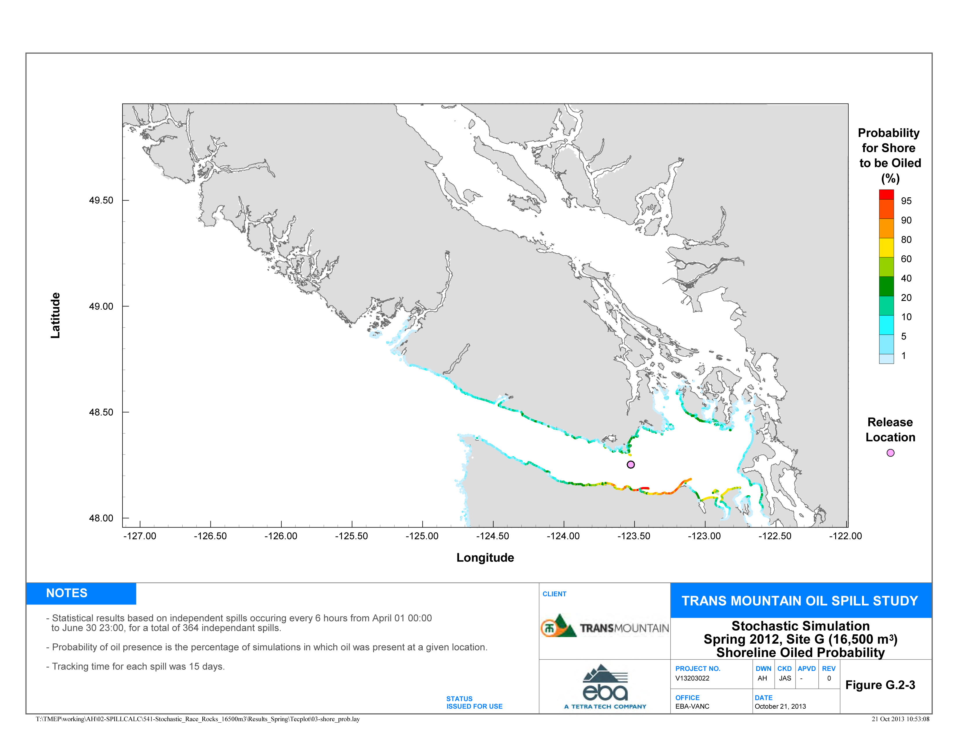
Site G – Probability for Shore to be Oiled (%)
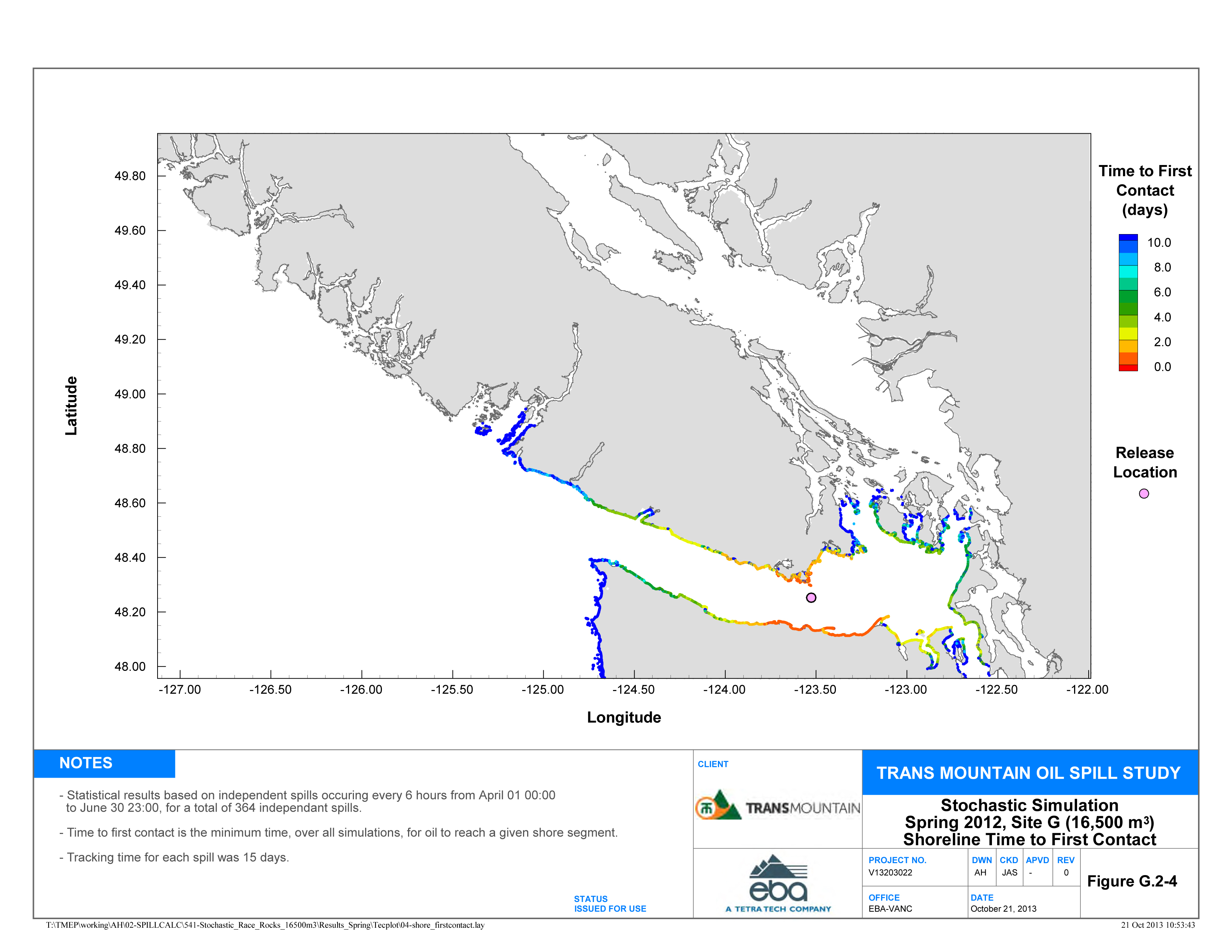
Site G – Time to First Contact (days)

Site H – Probability for Shore to be Oiled (%)
Site H – Time to First Contact (days)
FOR MORE INFORMATION AND ADDITIONAL MAPS:
Summary: Kinder Morgan Trans Mountain Expansion Project Application (December 16, 2013)
Link to the Complete Application (8 volumes. Search for files dated December 16 and 17, 2013. Spill scenario maps are included in Volumes 8C):
